A few months ago the RFS did a controlled burn in bushland on Middle Harbour River behind East Lindfield. Not long afterwards while running the trails I happened to glance up the hill into the recently burnt bush and saw what looked like man made stone walls about 20 metres from the trail. I went up to have a look and it turned out to be the ruins of several stone huts! I’ve passed by that place countless times but never knew what was hiding so close. It was only after the fire had burnt away the scrub that it became visible from the main track.

The huts are in a bad state with only the bottom half meter or so of the sandstone walls remaining. Some are in better condition than others with fireplaces still visible. There’s also a scattering of rubbish and other debris around.


There’s a few artefacts scattered around the site too, mostly broken bottles and pots. There’s writing visible on one of the (unfortunately broken) bottles reading “Laurel Kerosene” There is an entry on the MAAS site that depicts exactly the same bottle! There’s a lot of background on it, they were manufactured by Mobil’s predecessor company, Vacuum Oil between 1920 and 1940.


I took a number of other photos of the huts and some of the retaining walls built around them. Check them out here
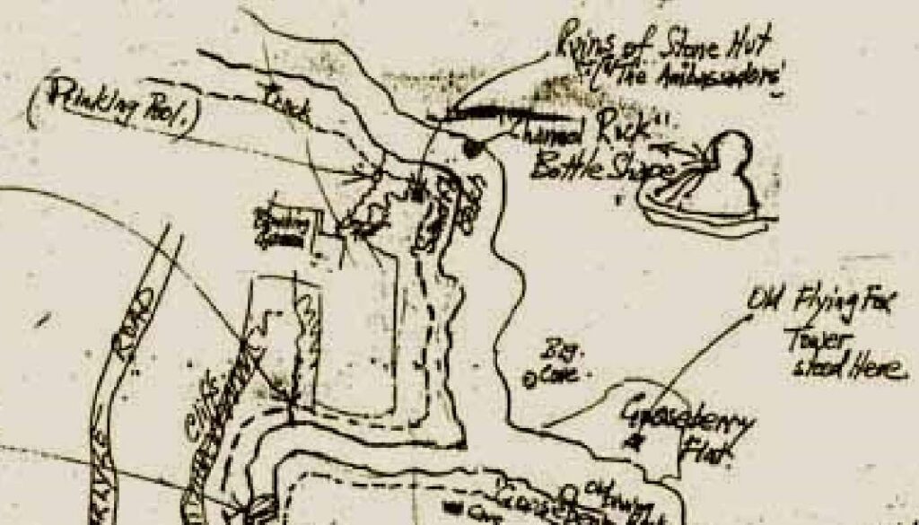
I’m really keen to learn the history of these places. I contacted my collaborator John, he’d heard of them before and knew of their location. He even had an old hand drawn map that marked the location of the huts and had them labelled as “The Ambassadors”

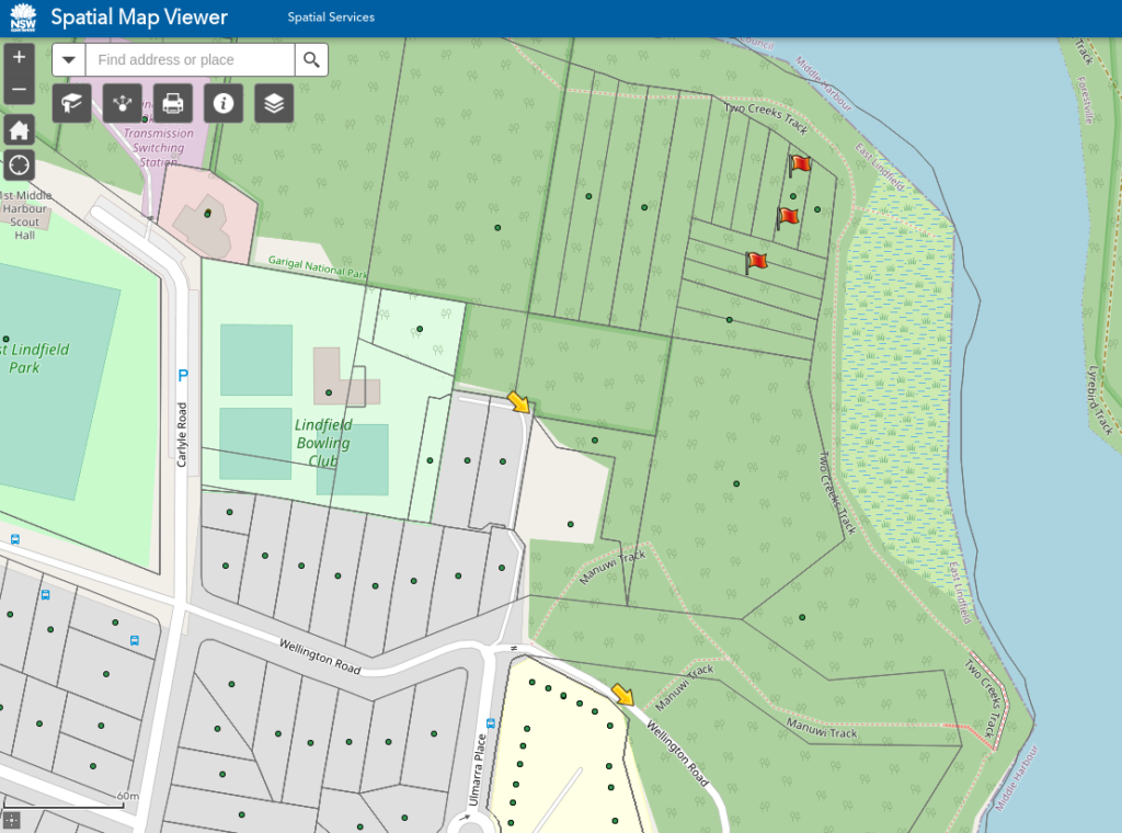
The NSW Spatial Map Viewer shows that the area of the ruins is just outside Garigal National Park and is divided up into properties and lots complete with address points.

There are two ways to get to the ruins. The most direct way is a trail that runs from an abandoned bowling green at the end of Wellington road right through the middle of the ruins. It then continues down to two creeks track on Middle Harbour River. This track is very rough and looks seldom used but it’s so close to civilisation the ruins must be known to locals and others.

The other way is to descend on Manuwi track at the end of Wellington Rd, East Lindfield. When it hits two creeks track turn left and walk for around 250m. There is a turnoff to the left to access the ruins at the trails highest point as it passes around the curve in the river.

I feel like there’s a lot more to be written about the ruins but this is all I know so far. I’m still looking around, John is rechecking his sources too for any more information so I hope to have some updates soon. If you know anything about these huts I’d love to hear from you!
Hi Joe,
Growing up and around the bush of East Lindfield my whole life with no knowledge of these huts I found your article fascinating. I have with other friends found similar remains from this era in other areas deeper within the bush of east lindfield as a child, and just recently went down to check out these huts from your article. It’s amazing what is still preserved bottles etc but sad to see so many smashed. It’s tempting to take them to ensure their safety but I left everything as I found it out of respect and hope others who venture hear treat the site with care. It’s interesting what little historical information is known on these sites after doing much research. If any further information is found or if I can provide any assistance to you or John with my knowledge of similar sites in the nearby area it would be my pleasure to help as I am equally intrigued by the history of east lindfield growing up hear my whole life.
Hey James,
That’s great you saw them, yes I’ve passed within meters of those huts for decades and never knew they were there. When I was writing the post I worried that it might expose the site to more damage from visitors. I’d love to know where the other ruins are and any information you have. There are other subdivided blocks in bushland marked on the spatial map that I’d been planning to explore but have not got around to doing.
Joe